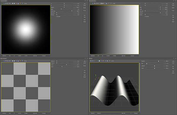
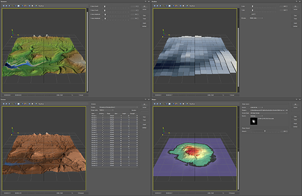
20 Constant, Filled, Gradient, Pattern and Shape Generators provide a wide range of heightmap and mask designs and layouts.
The generators can be used to create heightmaps, masks, or textures, and can be used in the main editor or saved to file.
Generator masks can be modified in many ways using the modifier devices to change exposure, deform the shape, or twist and swirl the texture.
The generators can be used on the Terrain Stack for powerful terrain creation, including mask references for the Shaper and other Devices.
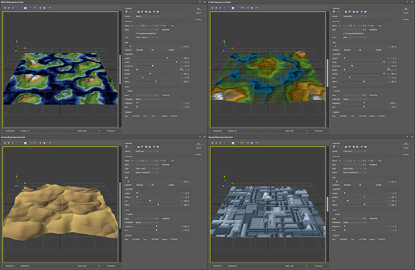
10 Noisemap Generators are available to create procedural gradient noise systems
The noise generators include multiple perlin type, gradient type, voronoi, plus multiple random noise generators.
Virtually unlimited heightmap and mask noise layouts can be created.
These devices also function on the Terrain Stack in multiple roles.
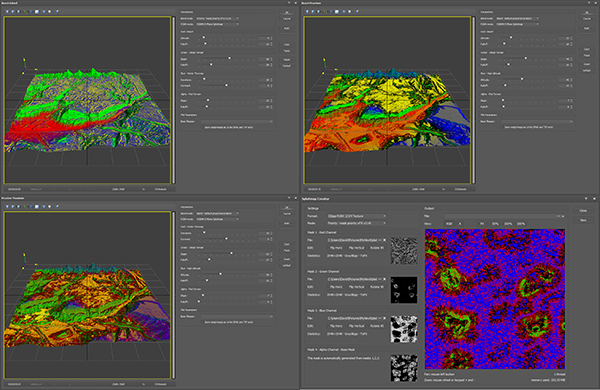
14 Weightmap Extractors create procedural weightmaps for use with layer and splatmap systems.
A Composite Weightmap tool combines up to three weightmaps using 28 different mathematical combine algorithms, such as steep slopes at only high altitudes.
Multiple weightmaps can be combined into splatmaps or material layer setups using the Splatmap Creator or Layer Creator.
Some of the devices such as erosion also create weightmaps that can be used in splatmaps.
TerreSculptor supports multiple splat texture systems.
Three comprehensive biome splatmap creators are available, plus a free-form splatmap creator that supports RGX, RGBX, and RGBAK splatmap types.
A 16-weightmap layer creator packs up to 16 weightmaps into correct level layers.
The terrain auto-material can also export its weightmap and splatmap textures, providing virtually unlimited texturing choices.
An upcoming Biome Region Painter will allow for creating custom biome regions on any heightmap texture set, which will pave the way for 25 to 125 texture multi-biome systems.
More than seventy general purpose heightmap and mask device modifiers are available to modify and deform the data to achieve unlimited effects.
Device modifiers range from subtle data modifications such as altitude and normalize to complex algorithms such as stratification and terraces.
Devices work immediately on the main editor terrain heightmap when chosen on the menus, to provide a simple user friendly interface.
Devices can also be placed onto the Terrain Stack for non-destructive workflows.
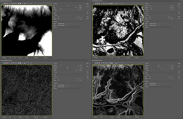
Five procedural erosion systems simulate a variety of real-world and computer-generated water flow and sediment and soil movement and thermal systems.
Water flow and sediment masks can be exported for creating weightmap and splatmap textures.
The erosion devices can also be added to the terrain stack to provide fast layered erosion effects such as hydraulic over rain.
The erosion algorithms are fully multi-threaded for exceptional performance.
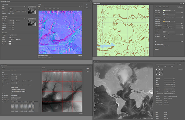
14 specialty create tools are provided to create assets for any game or film or visualization pipeline.
Bitplane packing and channel splitting, normalmap and splatmap creation, colorset and contour creation, satellite map to splatmap conversion, exporting split tiles, and more.
The Mapper and Topography Explorers allow navigating the world for downloading digital elevation models, contour map textures, street map textures, and satellite map textures.
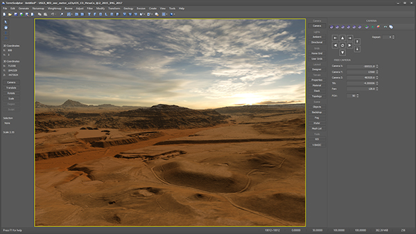
The function panels on the right provide access to a rich assortment of viewport tools for scene control and visualization.
Multiple cameras, multiple lights, multiple grids, and a wide variety of scene objects are available, including backdrops and fog and water.
3D viewport objects such as a world bounds cube and axis guides aid in creating large terrain systems.
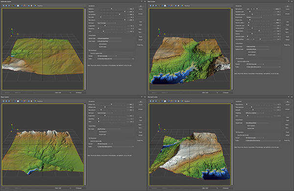
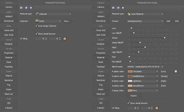
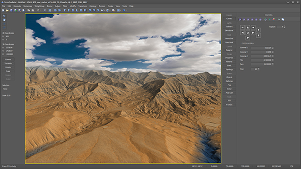
Five different types of terrain materials allow for coloring the terrain heightmap mesh using multiple algorithms and systems.
65536-color Colorsets and terrain mesh vertex colors and auto-material weightmaps and splatmaps can be exported to file.
The Terrain Stack provides a non-destructive multi-point-access layer type system for creating complex terrain heightmap and mask systems.
The stack supports up to 999 device items, with each device item containing a Datamap heightmap and three Datamap masks.
16 groups provide comprehensive sectional construction of multiple stack regions, and allow for non-incremental build order.
More than 130 total devices are available in TerreSculptor for use on the Terrain Stack.
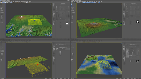
The terrain topology tools are a set of powerful 3D Gizmo and 3D Widget based editing systems.
Current topology tools can copy, cut, paste, deform, extend, merge, and paint alpha brush stamps onto the terrain heightmap.
Upcoming spline-based tools and free-form brush hand-painting are under development.
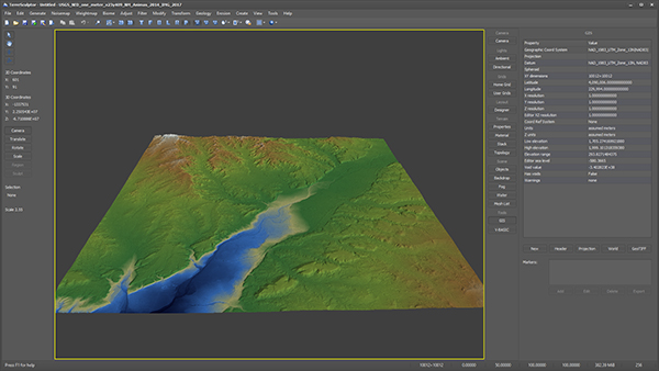
TerreSculptor has extensive GIS (Geographic Information System) support
Support for importing and exporting multiple Digital Elevation Model file formats with full support for Header and Projection files and Tags.
The Mapper Explorer and Topology Explorer tools built into TerreSculptor can download high resolution earth data directly in the editor.
The GIS toolkit is being expanded with tag conversion and re-projection systems.
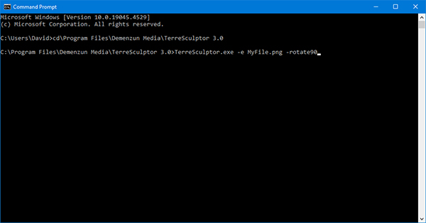
Exceptionally powerful utility features include Command-Line and Batch File support.
Opening files, converting files between dozens of file formats, and batch editing of files is provided.
Upcoming features under development include the Mesh List that manages white-box layouts of primitives such as proxy buildings, that can then be exported to other software for automatic layouts.
The upcoming VBASIC Language will allow for powerful scripting capabilities within the software.
Mesh to Heightmap conversion, GIS Projection, Satellite Image warping, Geology and Volcano tools, Snow and Grass tools, spline-based River and Road tools, plus much more is coming soon.
More than 3000 major features are still under active development to expand the capabilities of this powerful software even further.